

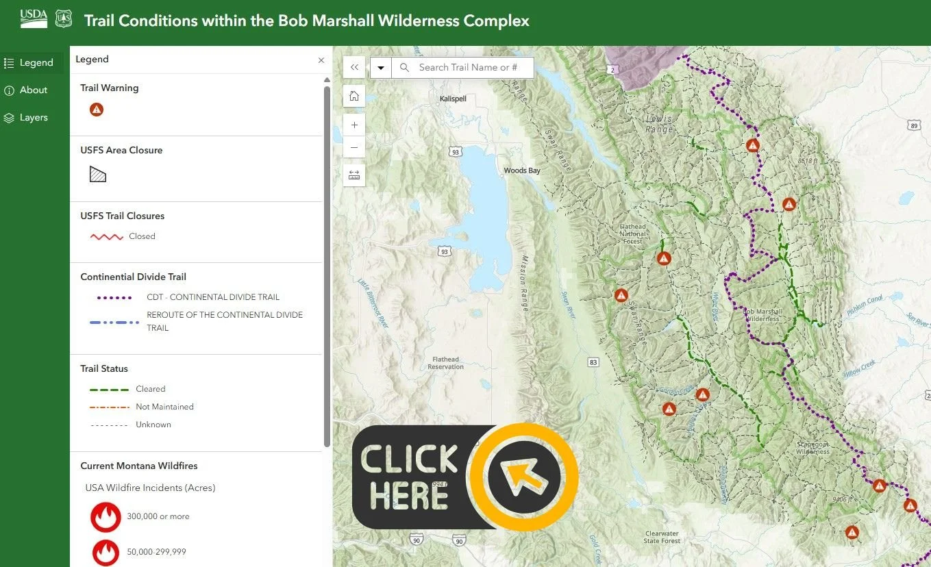
The interactive map and trail reports below display the dates that trails were cleared within the Bob Marshall Wilderness Complex. All trail condition updates are provided by the US Forest Service.
To use the map, click on the map image below. Map will load in a new window and may take a minute to fully load all the details. From there, accept the terms and conditions then you can scroll through map, zoom in and out and click map lines for more details.
*Please note: Always cross-reference the map with PDF Trail Reports linked below, and confirm with Forest Service District office for current trail conditions. Things can change quickly in the Bob!
Trail Reports
Click below for current Trail Reports from the USFS. These are updated as they come in.
National Forest Webpages
Another great place to check for current alerts, closures, and trail conditions:
Wilderness Safety & Fire Info
Always be prepared when planning a hiking or backpacking trip! Wilderness areas are much more rugged and remote than National Parks, and planning and preparation is key. Click the links below to learn more about potential hazards when planning a trip into The Bob.
***Remember — ALWAYS bring a map when heading into The Bob!
It doesn’t matter how short your hike is — you’re going to want a map. Trail conditions in the wilderness can change very quickly and game trails can be very deceiving. You can buy detailed maps from our website, or Forest Service maps from Ranger Stations around the Complex.